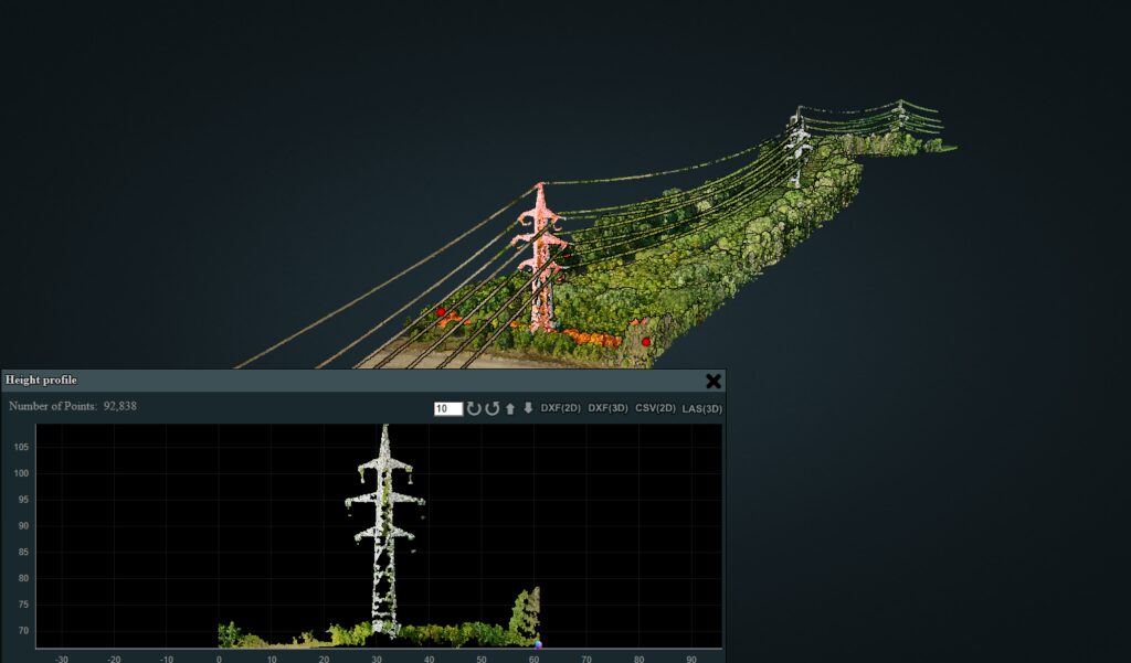
The Discover LIDAR portfolio consists of laser scanning projects made with LIDAR technology mounted on FAE drones, applied to irrigation, urban planning, road infrastructure design and execution, forest monitoring, and inspection of high-voltage lines and transformer stations.
Overhead power line corridor in forest
Online example of a point cloud classified into ground and remaining points, with distance, section, area and volume measurements plus CAD export.
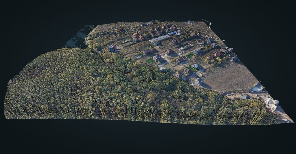
Branesti, urban area with forest and water
Online example of a point cloud classified into ground and remaining points, with distance, section, area and volume measurements plus CAD export.
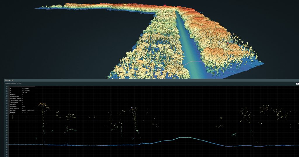
Mures dike with terrain cross-section
Online example of a point cloud classified into ground and remaining points, with distance, section, area and volume measurements plus CAD export.
A0 North motorway, lot 4
Online example of a point cloud classified into ground and remaining points, with distance, section, area and volume measurements plus CAD export.